Stay Connected on the Map. Stay Safe. Travel with Confidence.
Be-Maps is a free personal safety and location sharing application for Android and iOS that uses the Google Maps SDK to provide interactive maps enhanced with advanced location sharing and personal safety features.
Unlike traditional mapping applications that focus primarily on navigation, Be-Maps transforms interactive maps into a personal safety network. GPS location sharing, alerts mode, safety events, geofencing, location history, visits, proximity alerts, dashcam and navigation directions all work together from a single map interface.
Whether you are travelling, coordinating with family or closest friends, meeting, monitoring your important places, or helping elderly relatives, the interactive maps in Be-Maps keep trusted people connected and informed.
More Than Just Maps
Interactive maps are the heart of Be-Maps.
Every important feature in the application begins with the map. Instead of switching between multiple applications, you can view each other's locations, monitor important places, review previous journeys, receive alerts, navigate to destinations, and understand where events happened — all from one interactive map.
The familiar Google Maps experience is combined with Be-Maps' own safety and location-sharing technology, making maps more useful for everyday life, travel, and alert situations.
Recommended uses for Be-Maps:
• Family or close friends safety.
• Maps sharing.
• Home safety or apartment safety.
• Hotel room security.
• Travel safety.
• Monitoring your home or your hotel room.
• Remote monitoring.
• DashCam.
What You Can Do with Maps
Using the interactive maps in Be-Maps you can:
• View the GPS locations of trusted family members and friends.
• Share your own live location securely.
• Display personal safety events directly on the map.
• Browse historical GPS locations.
• Review your complete location history.
• Create GeoShapes for intelligent geofencing.
• Define Proximity between devices.
• Configure Visits.
• View live Google Maps traffic information.
• Switch between Standard and Satellite maps.
• Open any selected location directly in Google Maps for turn-by-turn navigation.
• Copy navigation directions for sharing with family members, friends, or emergency services.
• Estimate travel distance and arrival time.
Interactive Map Features
| Be-Maps Feature |
What it Does |
| Location Sharing |
See GPS locations of your Be-Maps Group members.
|
| Visit GeoShapes |
Define places to visit and receive reminders when you are nearby.
|
| Location History |
View historical movements directly on the map.
|
| DashCam |
Video recordings visible on the map. |
| Emergency alerts |
Share alerts with people in your group. |
| Safety Events |
Safety incidents appear directly on the map.
|
| Traffic Information |
See directly in Be-Maps the traffic conditions.
|
| Motion Detection |
Detects movement and saves photos and video.
|
| Motion Alerts |
Sounds and/or sends an alert when motion is detected. |
| Remote Notifications |
Sends motion & impact alerts to approved devices. |
| Proximity (Distance Alerts) |
Notifies if someone is too far or is close.
|
| GeoShapes (Geofencing) |
Notifications when someone 'is in' or 'is not' in the area.
|
| Remote Voice Message |
Play recorded message on remote device's speaker. |
| Navigation | Google Maps Directions |
Copy directions and open it directly in Google Maps.
|
| Remote Monitoring |
Remotely capture photos, record video, or monitor the surroundings using the monitoring device.
|
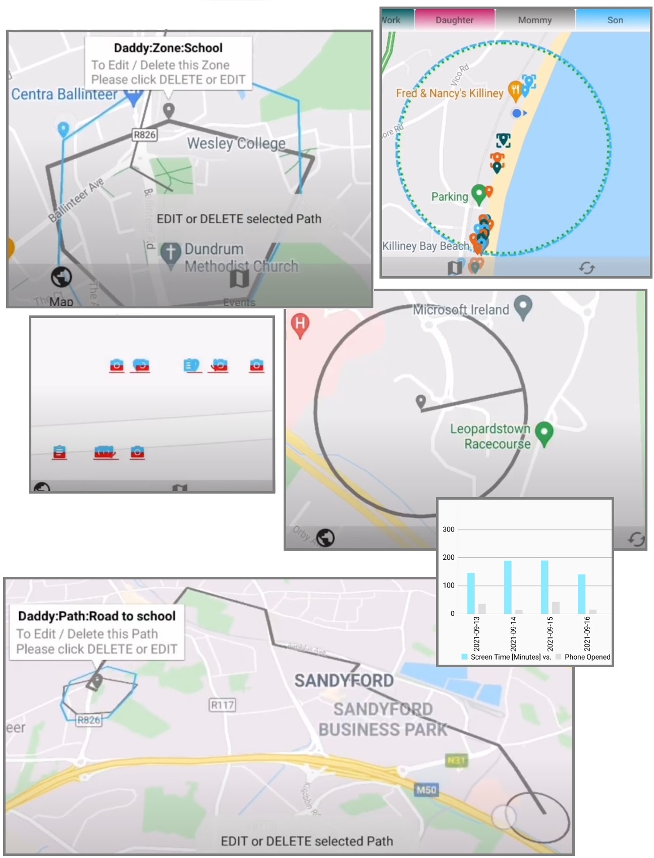
Maps: Main Features
Location Sharing
See the GPS locations of trusted members of your Be-Maps Group. Event data are also presented on the map.
Whether your family is travelling together or friends are meeting in different locations, everyone can quickly see where others are located on the interactive map.
GeoShapes (Geofencing)
Geofencing Alerts - Create zones on Map and receive notifications when someone 'is in' or 'is not' in the selected area.
Geo-fencing is useful for: children at school or on holiday, elderly family members, campsites, theme parks, beaches, schools, home, track road from school to home
Instead of constantly checking everyone's location, Be-Maps automatically notifies you when important movements occur.
Proximity (Distance Alerts)
Notifies if someone is too far or is close. Travelling in busy cities, nature areas or large tourist attractions can make it easy for someone to become separated from the group.
Know when trusted people are approaching your location or when a member of your group moves beyond a chosen distance, helping everyone stay together.
This feature is especially useful for:, Families with children, Walking tours, Theme park visits, Shopping centres, Ski holidays, Airports.
Visits
Define GeoShapes that keep track of location movements in relation to defined places to visit (for example a shop), these can remid Be-Maps Group members on their way to visit these places while they are close to them.
Location History
This can be very valuable information for each other's safety.
Be-Maps allows you to review previous GPS locations and historical movements directly on the map.
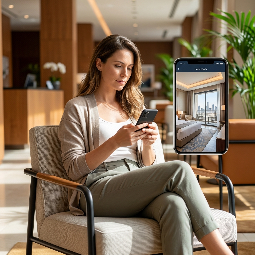
Other Map Features
Emergency alerts
Triggered or automated alerts in Be-Maps, and sharing the alert data with selected people from your group.
Navigation | Google Maps Directions
Open any selected location with directions directly in Google Maps for reliable turn-by-turn navigation.
Automated copy of navigation directions to your clipboard and easily share them with family members, friends, or emergency services.
Traffic Information
See directly in Be-Maps the current Google Maps traffic conditions before starting your journey to one of the events on the map and choose the most suitable route.
Satellite Maps
See directly in Be-Maps the satellite map view to identify the place you are looking for.
Safety Events
Safety alerts and important incidents appear directly on the map, allowing trusted people to immediately understand where assistance may be required.
Viewing events on the map provides valuable context that simple text notifications cannot.
DashCam
One minute long private video recordings visible on the map, with impact detection notification.
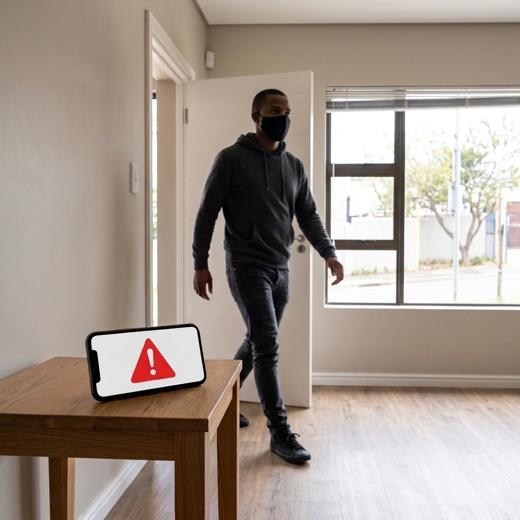
Monitoring on the map
Motion Detection
Detects movement in your home or your hotel room using your device's camera.
Automatically saves photos when motion is detected and next records a short video. Sends these data to the allowed devices.
Motion Alerts
Sounds and/or sends an alert when motion is detected.
Remote Notifications: Sends motion alerts, photos and videos to your approved Be-Maps devices.
Remote Monitoring
View your home or your hotel room remotely using another approved device.
Capture photos remotely from the monitoring device. Record video or surrounding remotely using the monitoring device.
Remote Voice Message
Record your voice message and play it remotely through the monitoring device's speaker.
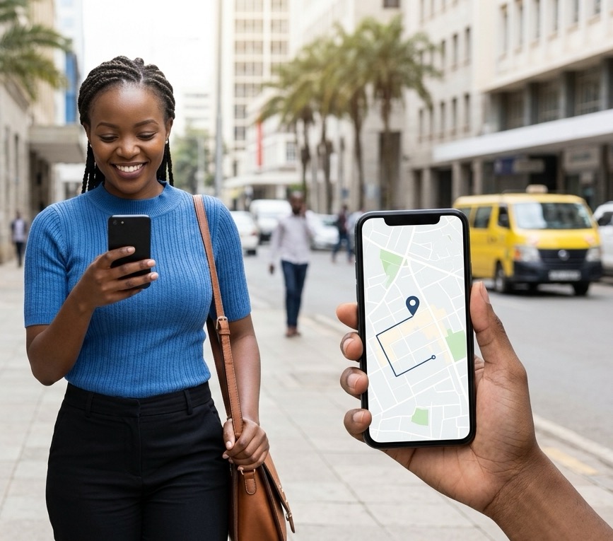
Additional Travel Safety Features
Be-Maps includes many other features designed to improve personal and family safety while travelling.
These include:
• Live location sharing with people you trust.
• Family and group location tracking.
• Geo-Fence notifications.
• Distance alerts when someone moves too far away.
• Find each other on the map.
• Alerts.
• Shared navigation and directions.
These features are especially useful for:
• Family holidays.
• Group travel.
• Business trips.
• Solo travellers.
• International travel.
Why Choose Be-Maps
Most map applications help you reach a destination.
Be-Maps helps you stay connected with the people who matter most.
By combining interactive maps with live GPS location sharing, geofencing, location history, navigation and safety features, Be-Maps offers much more than a traditional mapping application.
It becomes a complete location-sharing and personal safety network.
People use Be-Maps to help improve awareness and security while at or away from home by providing:
• Family travel safety, or commuting safety.
• Location sharing.
• Travel safety notifications.
• Remote voice alerts.
• Your room motion detection.
• Your home monitoring.
• Home or Hotel security alerts.
• Remote room monitoring from another device.
• Motion-triggered photo and video capture.
• Personal safety tools for travellers.
Whether you are at home, at work, at school, travelling alone, travelling with family, or travelling for business, Be-Maps helps you stay connected on the map with many safety features, monitor your room remotely, and keep your or trusted people informed about unexpected activity.
Privacy and Legal Notice
Privacy, surveillance, audio recording, and video recording laws differ between countries. Before using monitoring features, especially when travelling internationally, obtain appropriate legal advice if necessary and ensure you have permission where required.
Users are responsible for ensuring that their use of Be-Maps complies with local laws and regulations. If you are unsure whether these features may be used in your location, seek appropriate legal advice before using them.
Frequently Asked Questions:
What maps does Be-Maps use?
Be-Maps uses the Google Maps SDK to provide interactive maps on Android and iOS.
Can I share my current GPS location?
Yes. Be-Maps lets you securely share your GPS location with trusted members of your Be-Maps Group.
Is Be-Maps a navigation app?
In Be-Maps you can tap on a location and hold on its location tag, this will automatically copy the Google Maps directions to your clipboard, which you can share via a message with people you trust or emergency services, and it will open Google Maps app with the directions from you to the location you choose. This way Be-Maps supports the navigation directions, but it is not a navigation app.
Can I create geofences?
Yes. Be-Maps allows you to create custom GeoShapes for roads or around homes, schools, workplaces, hotels, parks, and other important locations.
Can I review previous locations?
Yes. Your location history and previous visits can be viewed directly on the interactive map.
Can I navigate using Google Maps from Be-Maps location?
Yes. Any selected location in Be-Maps can be opened directly in Google Maps for turn-by-turn navigation.
Does Be-Maps display traffic information?
Yes. Be-Maps displays current Google Maps traffic information to help you plan your journey.
Is Be-Maps free?
Yes. Be-Maps is a free application for Android and iOS.